Is Ice Age Floods National Geologic Trail worth it?
This is not a park you visit so much as a region you decode.
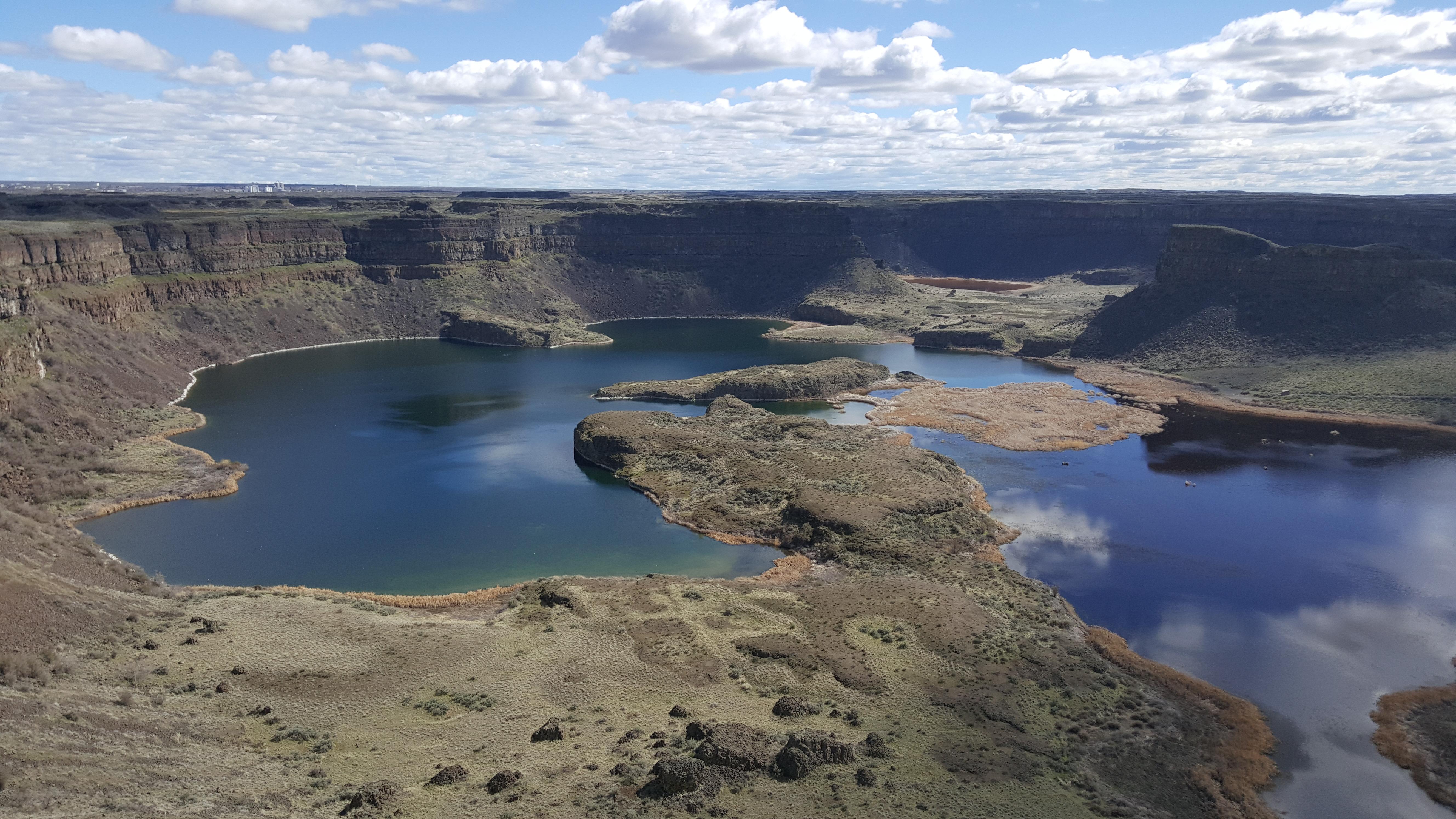
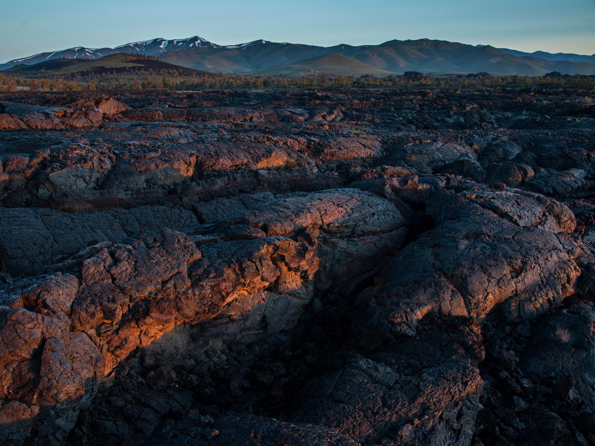
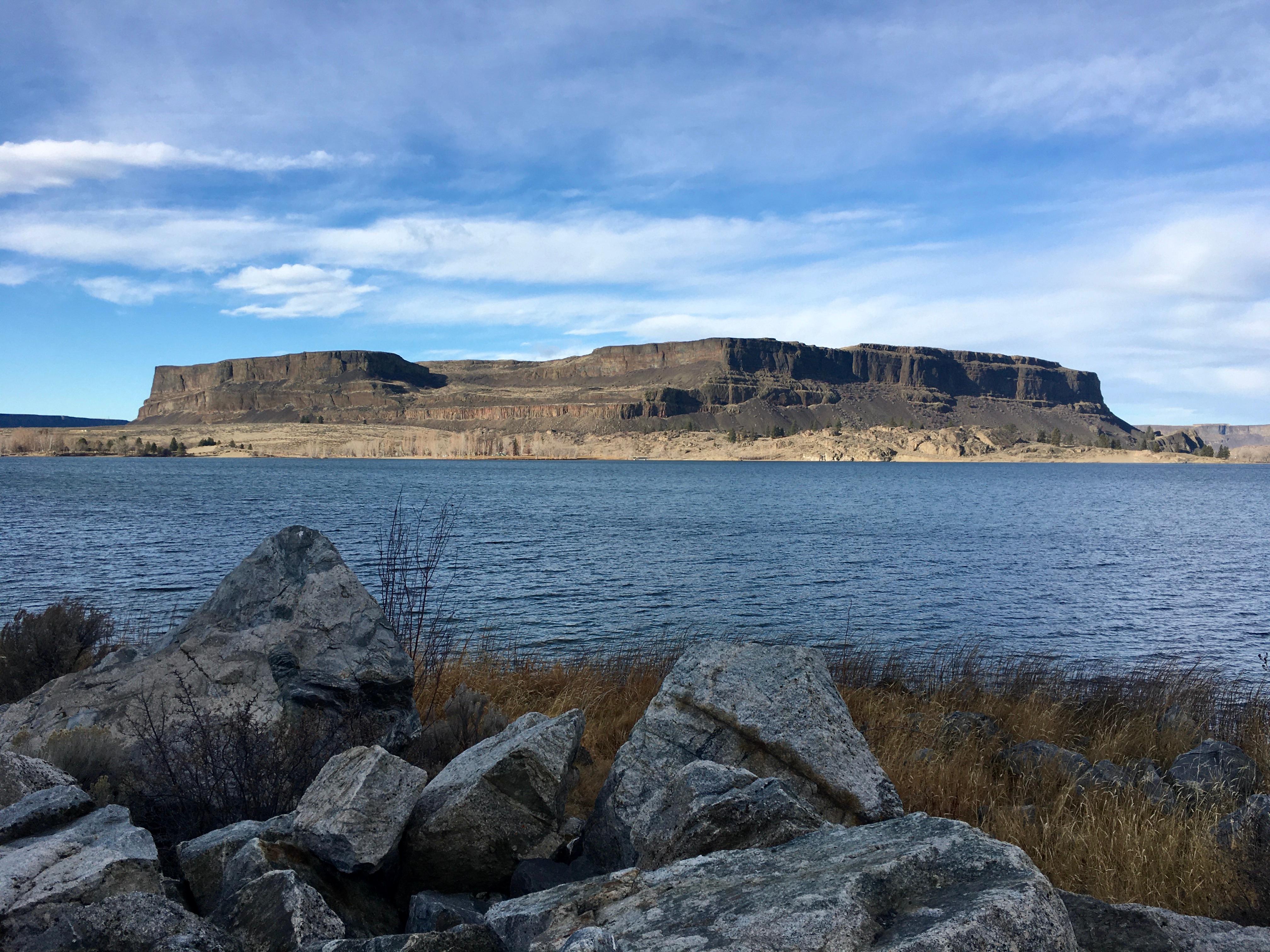
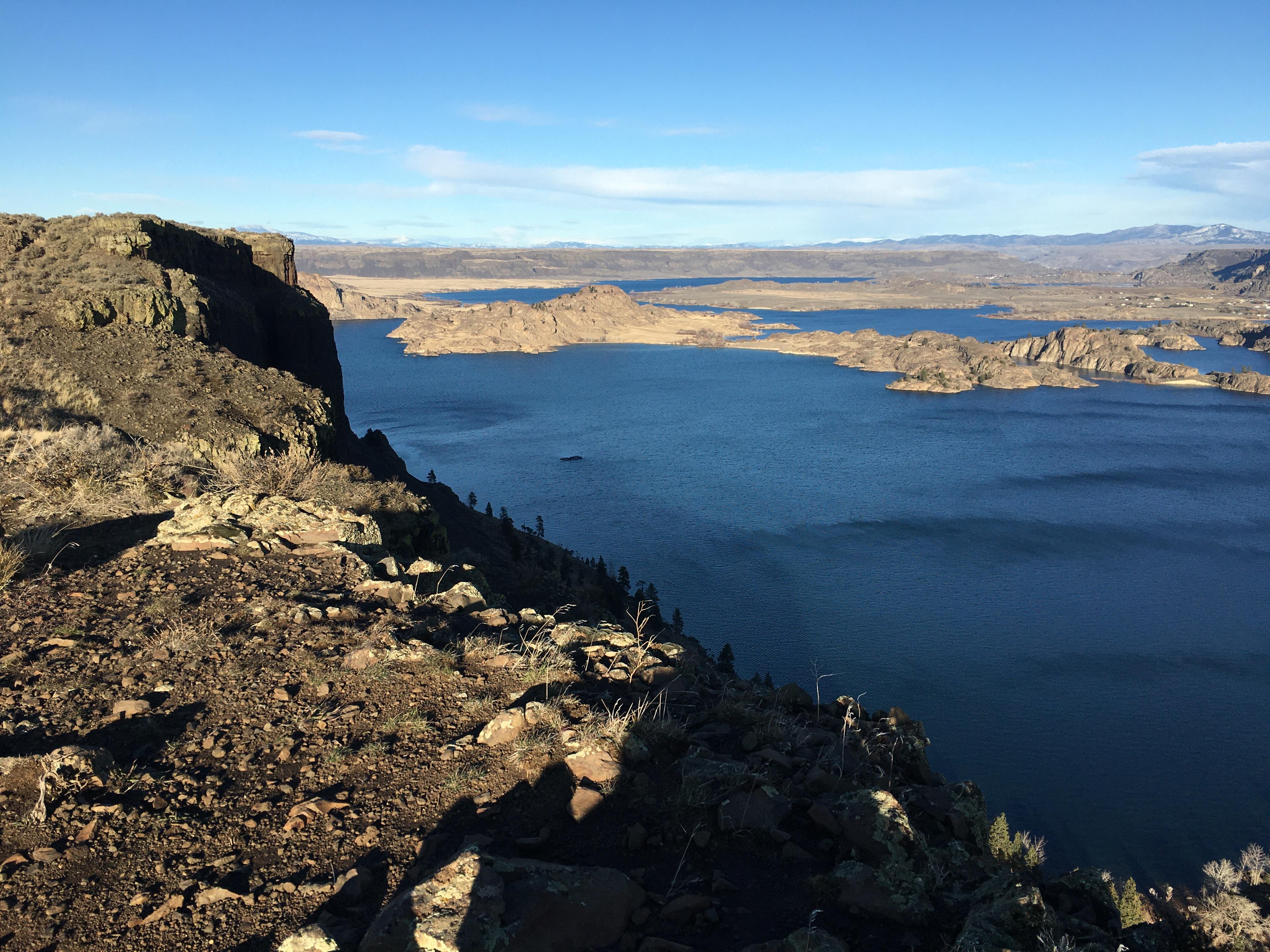
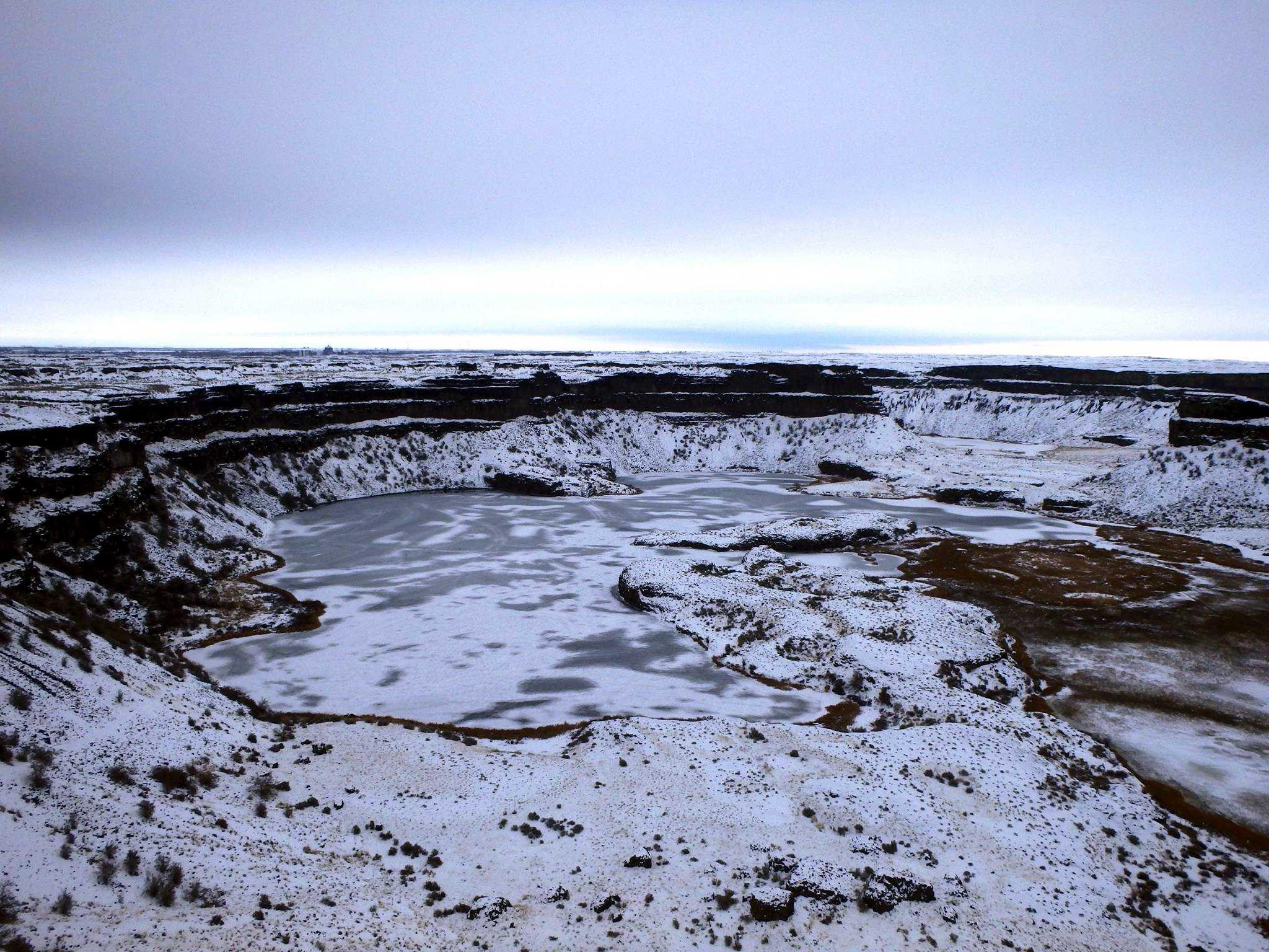
Spread across four states, the Ice Age Floods trail connects dozens of sites where catastrophic flooding carved coulees, scablands, and gorges across the Pacific Northwest roughly 15,000 years ago. With a score of 38, it rewards the intellectually curious far more than the activity-seeker. There are no maintained loops or campgrounds here, just geology at a scale that genuinely reframes how you see the landscape. Free to access, but it demands planning and a real appetite for the subject.
Who it is for
Road-trippers already moving through WA, OR, ID, or MT who love geology or deep history will find this endlessly rewarding. Families with curious kids can tap the Junior Ranger program. Casual visitors expecting a single destination will be frustrated by the fragmented, self-directed format.
Highlights
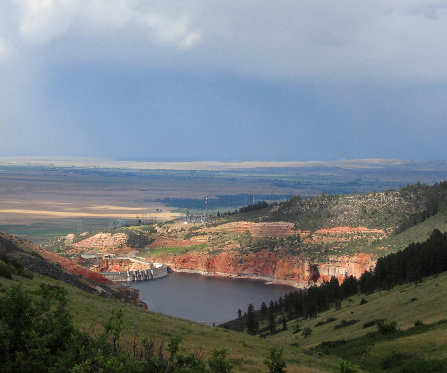
- Auto touring across four states to trace the actual flood path, from the ice dam site in Idaho to the Columbia River corridor
- Guided tours at select partner sites that explain how ice dam collapses reshaped entire river systems overnight
- Junior Ranger program that turns the abstract geology into a concrete, kid-friendly investigation
- Walking self-guided sites where flood-scoured terrain is visible at ground level, making the scale of the catastrophe tangible
Editor's tipBefore you go, download or order the official Ice Age Floods tour map and identify which specific partner sites fall along your existing route, since trying to visit sites across all four states in one trip is impractical. Hours and access vary site by site, so confirm each stop individually before building your itinerary.